Historic Ransom Place, Indianapolis
Historic Ransom Place covers 1.6 square miles of Indianapolis, and about 4,238 people live here. This page maps 22 parks and public places and 4 businesses inside its lines, most of them Entertainment and Arts.

Living In Historic Ransom Place
Historic Ransom Place has about 4,238 people on 1.6 square miles, 2,713 per square mile, denser than Indianapolis as a whole (2,403).
The median household earns $38,141 a year, 42% below the city median, #69 of 75 neighborhoods.
71% of homes are rented, and the median rent is $1,068 a month.
It is an older part of town: 62% of homes were built before 1960.
People here skew younger, with a median age of 29 against 34 citywide.
9% of workers walk to work, against 2% across Indianapolis.
89% of homes have broadband internet.
Inside its lines: 8 places of worship, 7 parks, 2 fire stations, 2 landmarks and historic sites and 1 places to eat.
People
Money And Work
Housing
Getting Around
Connected
US Census Bureau American Community Survey 2020 to 2024, added up from the census tracts in Historic Ransom Place. Ranks count neighborhoods with 500 or more people.
Parks, Schools And Public Places In Historic Ransom Place
Places Of Worship 8
- Church-Pentecost1520 West Ohio Street, Indianapolis, IN 46222
- Ethiopian Orthodox Tewahido Church1200 West Ray Street, Indianapolis, IN 46221
- Mount Vernon Community Missionary Baptist Church709 North Belmont Avenue, Indianapolis, IN 46222
- New Zion Community Church955 Oliver Avenue, Indianapolis, IN 46221
- The Church of Jesus Christ of Latter-day Saints
- Tree of Life Christian Ministries125 North Harding Street, Indianapolis, IN 46222
- Westside Apostolic Pentecostal Church
- Westside Missionary Baptist Church1941 West Saint Clair Street, Indianapolis, IN 46222
Parks 7
 White River Gardens
 White River State Park
- Indianola Park
- Lentz Park
- McCarty Triangle Park1101 West McCarty Street, Indianapolis, IN 46221
- Riley Park
- Stringtown Park1605 West Ohio Street, Indianapolis, IN 46222
Fire Stations 2
- Indianapolis Fire Station 1
- Indianapolis Fire Station 19
Landmarks And Historic Sites 2
- International Chimpanzee Complex Community Hub
- Skyline
Clinics 1
- Dialysis Clinic1719 West 10th Street, Indianapolis, IN 46222
Community Centers 1
- The Lord's Pantry at Anna's House303 North Elder Avenue, Indianapolis, IN 46222
Trails And Bike Paths 1
- Old Washington Street Bridge
Places To Go In Historic Ransom Place
The most reviewed spots inside these lines, with photos where they have one.
Top Attractions And Things To Do
Parks, Beaches, Museums And Landmarks
Businesses In Historic Ransom Place
Is yours missing or wrong? List or fix it free.
Entertainment and Arts 2
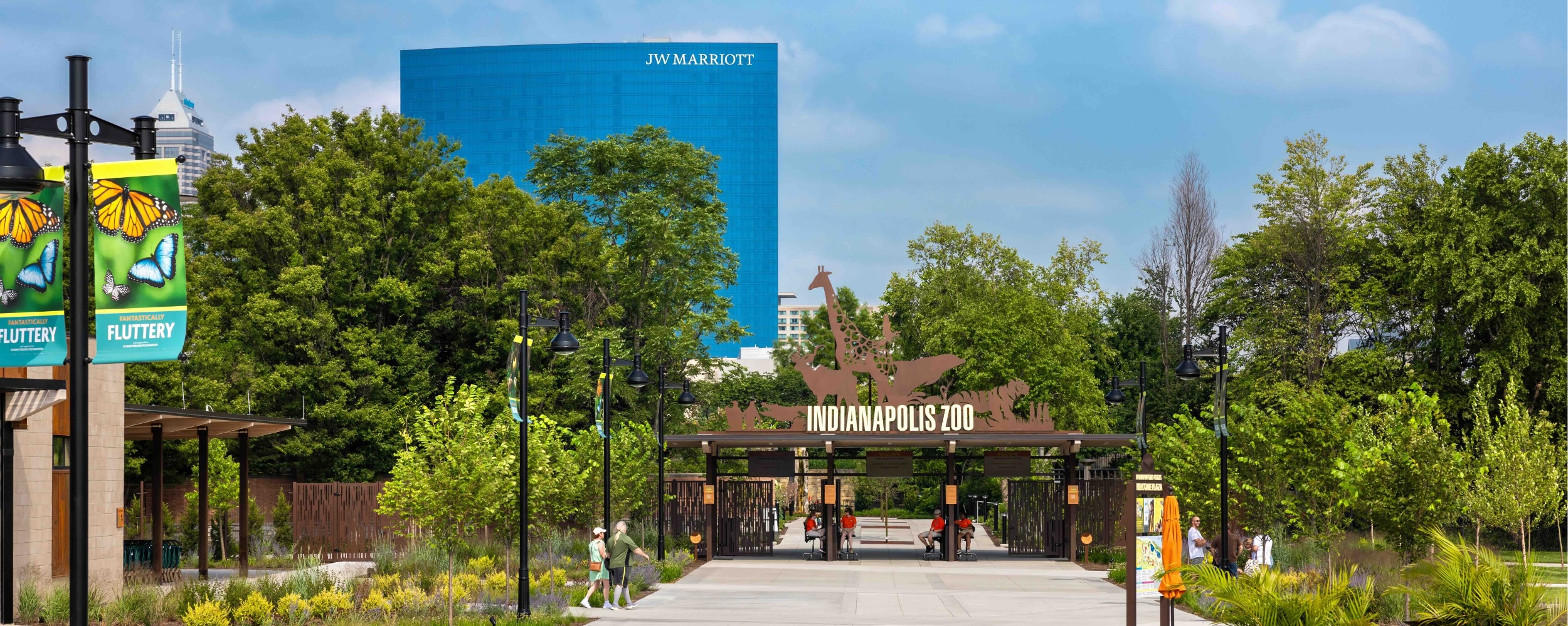 Indianapolis ZooZoo
- St. Vincent Dolphin PavilionAquarium
Parks and Recreation 1
 White River GardensBotanical garden
Food and Drink 1
 Taco BellFast food restaurant
Own A Business In Indianapolis
List it free on your neighborhood page in about two minutes. Townstoop is built by Clickflame, building local business sites since 2004.
Historic Ransom Place Questions
How many people live in Historic Ransom Place
About 4,238, from the Census American Community Survey tracts inside the Historic Ransom Place lines.
What parks are in Historic Ransom Place
7 mapped, including Indianola Park, Lentz Park, McCarty Triangle Park, Riley Park.
What is the rent like in Historic Ransom Place
The Census median gross rent is $1,068 a month, against $1,156 for all of Indianapolis.
Do people rent or own in Historic Ransom Place
71% of homes are rented and 29% are owned, against 44% rented across Indianapolis.
How do people get to work from Historic Ransom Place
The average commute is 21 minutes. 65% drive alone, 2% take transit, 9% walk and 12% work from home.
How old are the homes in Historic Ransom Place
62% were built before 1960 and 15% in 2010 or later. 64% are single family homes.
Is Historic Ransom Place a family neighborhood
19% of households have children and 23% of residents are under 18. 5% are 65 or older.
Sources, Census figures from the US Census Bureau American Community Survey five year estimates, parks, schools and public places from OpenStreetMap contributors (ODbL). How we build these pages.