Massachusetts Avenue Commercial District, Indianapolis
Massachusetts Avenue Commercial District covers 0.4 square miles of Indianapolis, and about 4,219 people live here. This page maps 11 parks and public places and 18 businesses inside its lines, most of them Food and Drink.
- #1 Most Packed In Indianapolis11,623 people per square mile
- #2 Most Walkable In Indianapolis18% walk to work
- #3 Newest Homes In Indianapolis46% built since 2010

Massachusetts Avenue Commercial District In Pictures
Parks, landmarks and local spots inside these lines. Tap a photo to open its page.
Living In Massachusetts Avenue Commercial District
Massachusetts Avenue Commercial District has about 4,219 people on 0.4 square miles, 11,623 per square mile, denser than Indianapolis as a whole (2,403).
The median household earns $82,204 a year, 24% above the city median, #25 of 75 neighborhoods.
76% of homes are rented, and the median rent is $1,489 a month.
It is still growing: 46% of homes were built in 2010 or later.
People here skew younger, with a median age of 32 against 34 citywide.
18% of workers walk to work, against 2% across Indianapolis.
92% of homes have broadband internet.
Inside its lines: 2 museums, 2 parks, 2 places of worship, 1 civic building and 11 places to eat.
People
Money And Work
Housing
Getting Around
Connected
US Census Bureau American Community Survey 2020 to 2024, added up from the census tracts in Massachusetts Avenue Commercial District. Ranks count neighborhoods with 500 or more people.
Parks, Schools And Public Places In Massachusetts Avenue Commercial District
Museums 2
- James Whitcomb Riley Home528 Lockerbie Street, Indianapolis, IN 46202
- The Hall202 North Alabama Street, Indianapolis, IN 46204
Parks 2
- Cummins Meadow
- Richard G. Lugar Plaza
Places Of Worship 2
- Roberts Park United Methodist Church401 North Delaware Street, Indianapolis, IN 46204
- Saint Mary's Catholic Church325 North New Jersey Street, Indianapolis, IN 46202
Civic Buildings 1
 City-County Building200 East Washington Street, Indianapolis, IN 46204
Landmarks And Historic Sites 1
- The Dartmouth221 East Michigan Street, Indianapolis, IN 46204
Schools 1
- Saint Marys School
Theaters 1
 Old National Centre502 North New Jersey Street, Indianapolis, IN 46204
Trails And Bike Paths 1
- East Market MUP
Places To Go In Massachusetts Avenue Commercial District
The most reviewed spots inside these lines, with photos where they have one.
Parks, Beaches, Museums And Landmarks
Where To Eat
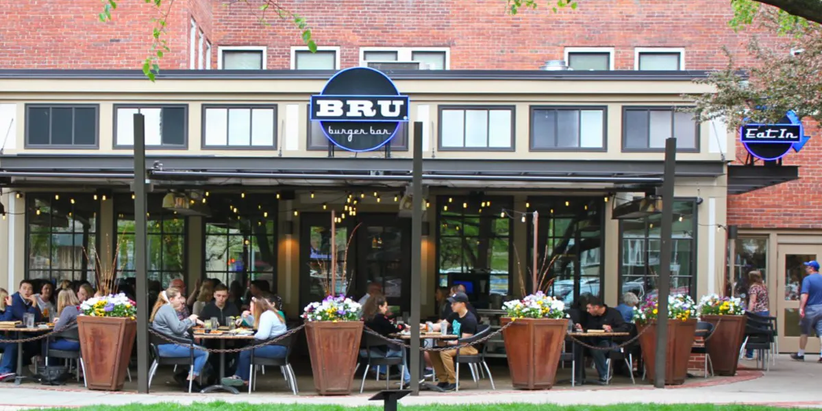 BRU Burger Bar IndianapolisHamburger restaurant in Massachusetts Avenue Commercial District4.5 stars, 5,524 reviews
 The Eagle Mass AveRestaurant in Massachusetts Avenue Commercial District4.5 stars, 5,198 reviews
 The RathskellerGerman restaurant in Massachusetts Avenue Commercial District4.5 stars, 4,229 reviews
 Bakersfield Mass AveRestaurant in Massachusetts Avenue Commercial District4.6 stars, 3,543 reviews
 Salt on MassSeafood restaurant in Massachusetts Avenue Commercial District4.8 stars, 3,136 reviews
 Condado TacosTaco restaurant in Massachusetts Avenue Commercial District4.4 stars, 3,027 reviews
Businesses In Massachusetts Avenue Commercial District
Is yours missing or wrong? List or fix it free.
Food and Drink 11
- BRU Burger Bar IndianapolisHamburger restaurant
- The Eagle Mass AveRestaurant
- The RathskellerGerman restaurant
- Bakersfield Mass AveRestaurant
- Salt on MassSeafood restaurant
- Condado TacosTaco restaurant
 BazbeauxPizza restaurant
- Goodfellas Pizzeria - Mass AvePizza restaurant
- Dave's Hot ChickenChicken restaurant
- Fat Dan's DeliAmerican restaurant
1 more on the map below
Groceries and Markets 3
 Whole Foods MarketGrocery store
 Indianapolis City MarketMarket
- Needler's Fresh MarketGrocery store
Events and Weddings 1
 Old National CentreLive music venue
Entertainment and Arts 1
- Murat TheatrePerforming arts theater
Bars and Nightlife 1
 St. Joseph BreweryBrewpub
Legal 1
 Hankey Marks & CriderSocial security attorney
Neighborhoods Near Massachusetts Avenue Commercial District
Own A Business In Indianapolis
List it free on your neighborhood page in about two minutes. Townstoop is built by Clickflame, building local business sites since 2004.
Massachusetts Avenue Commercial District Questions
How many people live in Massachusetts Avenue Commercial District
About 4,219, from the Census American Community Survey tracts inside the Massachusetts Avenue Commercial District lines.
What parks are in Massachusetts Avenue Commercial District
2 mapped, including Cummins Meadow, Richard G. Lugar Plaza.
How many schools are in Massachusetts Avenue Commercial District
1 schools are mapped inside the neighborhood.
What is the rent like in Massachusetts Avenue Commercial District
The Census median gross rent is $1,489 a month, against $1,156 for all of Indianapolis.
Do people rent or own in Massachusetts Avenue Commercial District
76% of homes are rented and 24% are owned, against 44% rented across Indianapolis.
How do people get to work from Massachusetts Avenue Commercial District
The average commute is 22 minutes. 55% drive alone, 3% take transit, 18% walk and 21% work from home.
How old are the homes in Massachusetts Avenue Commercial District
23% were built before 1960 and 46% in 2010 or later. 17% are single family homes.
Is Massachusetts Avenue Commercial District a family neighborhood
1% of households have children and 1% of residents are under 18. 7% are 65 or older.
Sources, Census figures from the US Census Bureau American Community Survey five year estimates, parks, schools and public places from OpenStreetMap contributors (ODbL). How we build these pages.